Bluebonnet Trail Phase 2
Bluebonnet Trail Phase 2
Overview
ABOUT THE PROJECT
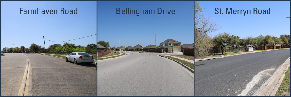
The City of Austin is improving the safety and mobility of streets serving Bluebonnet Trail Elementary School and the Bellingham Meadows and Harris Branch neighborhoods. Informed by the District 1 Safe Routes to School Infrastructure Report, along with an analysis of speeding, crash history, as well as bicycle and pedestrian network gaps, the City is making changes to Farmhaven Road from Kirkwynd Drive to Bellingham Drive, St. Merryn Road from Kirkland Hill Path to Farmhaven Road and Bellingham Drive from Farmhaven Road to Boyce Lane.
Funding for these improvements is made possible through the Safe Routes to School, Bikeways, Vision Zero, and Speed Management programs from the 2020 Mobility Bond Program.

CONSTRUCTION UPDATES
The City of Austin has completed safety upgrades near Bluebonnet Trail Elementary School as part of the Safe Routes to School Program. Crews installed new flashing, solar-powered school zone beacons at the following locations:
- Farmhaven Road and Kirkwynd Drive
- Farmhaven Road west of Harris Branch Parkway
- Farmhaven Road east of Winterbourne Court
These improvements are designed to increase driver awareness and support safer travel for students walking and biking to school. The upgrades were recommended based on field observations and the Safe Routes to School Infrastructure Report.
Learn more at austintexas.gov/SafeRoutes.

The first phase of improvements was completed in October 2025 and included new pedestrian crossing islands and sidewalk improvements at various locations in the area (see the Phase 1 fact sheet for additional details).
Implementation of the second phase of improvements began in March, with crews focusing on the following changes:
- A new protected two-way bike lane on Farmhaven Road from Kirkwynd Drive to Bellingham Drive
- New protected one-way bike lanes on:
- St. Merryn Road (Kirkland Hill Path to Farmhaven Road)
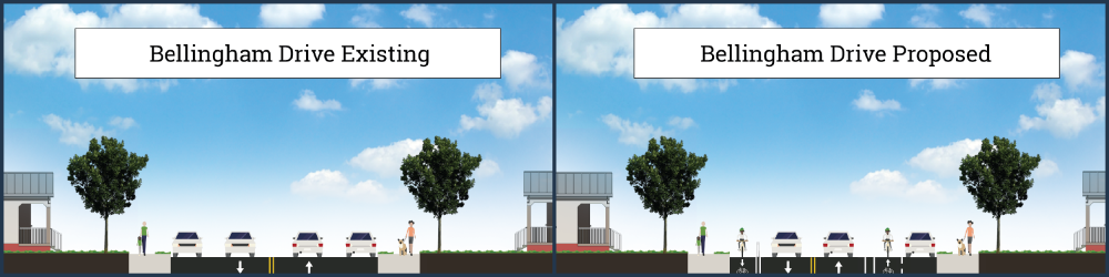
- Bellingham Drive (Farmhaven Road to Boyce Lane)
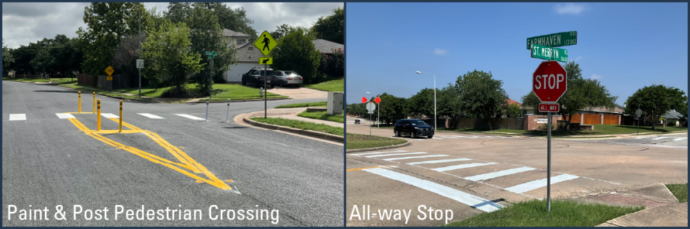
- New pedestrian crossing islands with flexible posts on St. Merryn Road
- Intersection safety improvements at:
- Harris Branch Parkway & Farmhaven Road
- Harris Branch Parkway & St. Merryn Road
- Parking consolidation to key neighborhood areas to support safer travel and maintain access for all roadway users
The construction timeline is dependent on weather and other unforeseen delays.
- Slow speeds to more appropriate neighborhood levels. Current average speeds on Farmhaven Road, St. Merryn Road and Bellingham Drive exceed the posted 30 mph limit. On Farmhaven Road, more than 60% of drivers exceed the speed limit. On St. Merryn Road, 78% of drivers exceed the speed limit.
- Improve the safety and comfort of crossing Harris Branch Parkway at St. Merryn Road and Farmhaven Road. These intersections account for $7.97 million in comprehensive crash costs over the past five years.
- Provide options for more comfortable biking and walking for exercise, traveling to and from school, visiting neighbors or accessing nearby destinations.
Yep — I stripped too much. Here’s the **same full content preserved**, just cleaned into standard COA styling with responsive images, rounded corners and consistent headers. Source content preserved from your pasted block. ```html
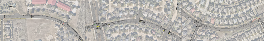
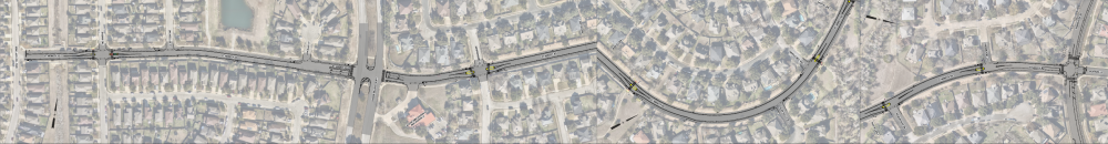
Proposed changes are organized into three sections:
Farmhaven Road currently serves access to Bluebonnet Trail Elementary School and crosses Harris Branch Parkway to serve access into the Bellingham Meadows and Harris Branch neighborhoods.
- Two new pedestrian crossing islands are proposed at Winterborne Court and at Lansdowne Road. Three other pedestrian crossings were recently constructed near Bluebonnet Trail Elementary School, two near the school and one at Kirkwynd Drive. Pedestrian crossing islands help make crossings much more comfortable and safer for pedestrians by encouraging drivers to yield and breaking up the crossing into two stages so people crossing the street, especially young children and people who move more slowly, can focus on one direction of travel at a time. Crossing islands also help slow motor vehicle speeds when placed in series with one another, as proposed here.
- Two new all-way stops with high visibility crosswalks were recently installed at St. Merryn Road and at Bellingham Drive. This will help make interactions between people walking, driving and bicycling much more predictable, visible and safer.
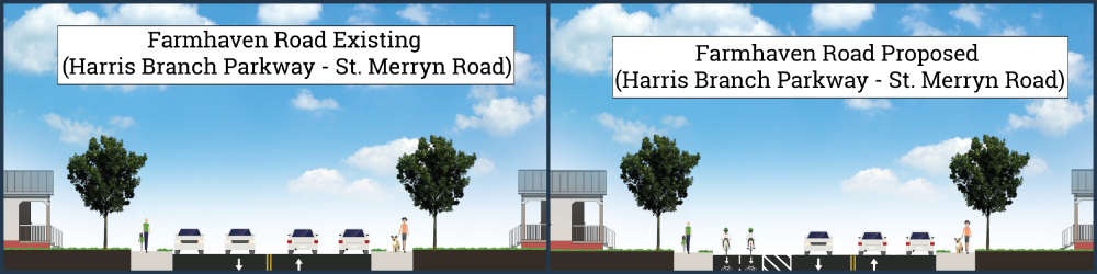
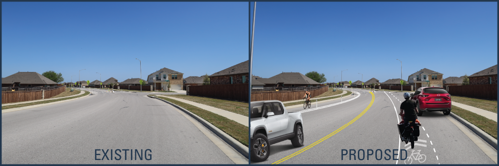
- A new two-way protected bikeway is proposed from Kirkwynd Drive to Bellingham Drive to provide a higher-comfort bikeway that connects nearby neighborhoods to the school, community center and pocket parks.
- The two-way design also allows for on-street parking to be preserved on both sides of the street near the school for pick-up and drop-off access.
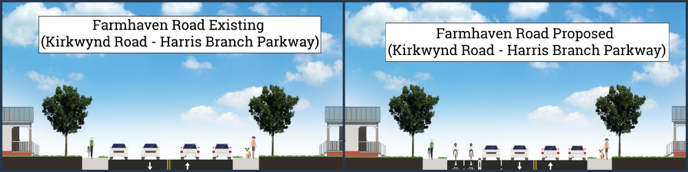
- From Harris Branch Parkway to St. Merryn Road, parking would be consolidated to the south side of the street and the bikeway on the northern side of the street will be protected with a wide buffer. This design is expected to support slower speeds while also providing for on-street parking on one side of the street.
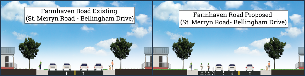
- From St. Merryn Road to Bellingham Drive, on-street parking would be removed on the north side of the street and the two-way bikeway would continue along the north curb to meet up with a concrete pathway connecting to Bellingham Road.
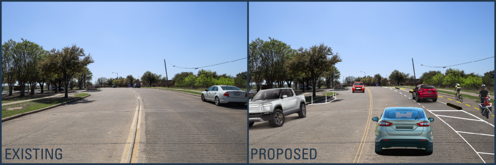
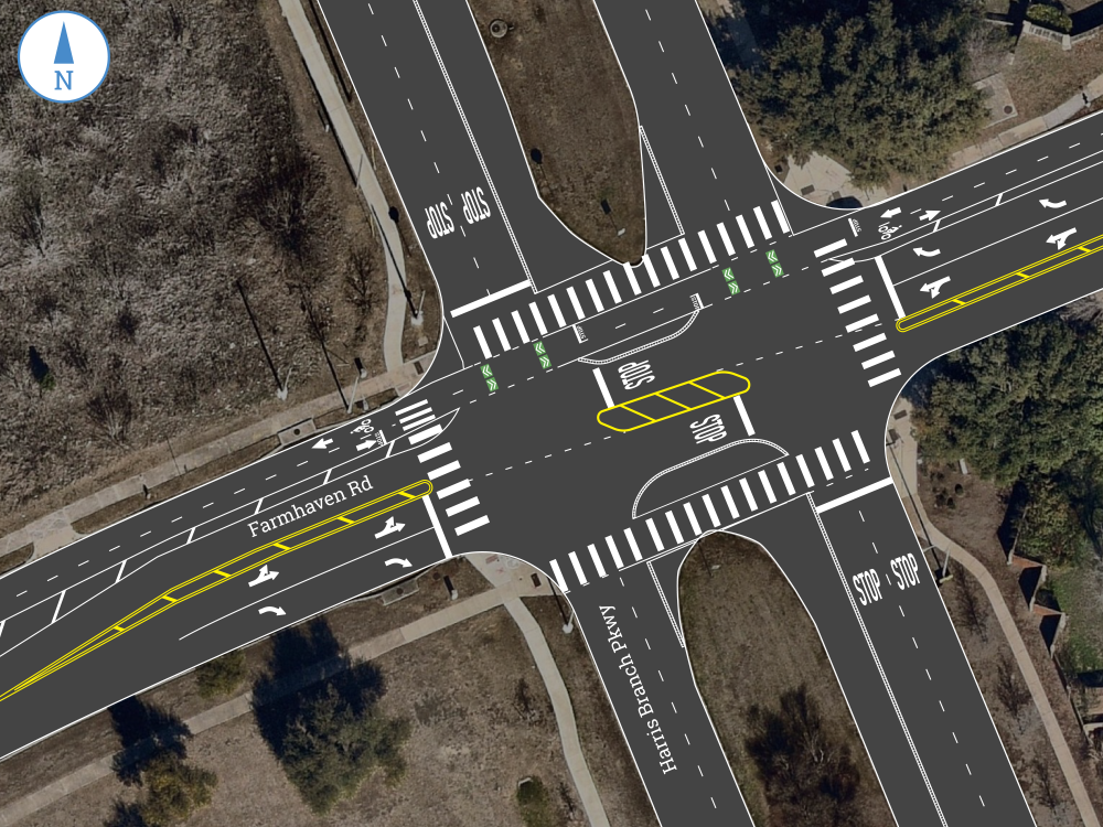
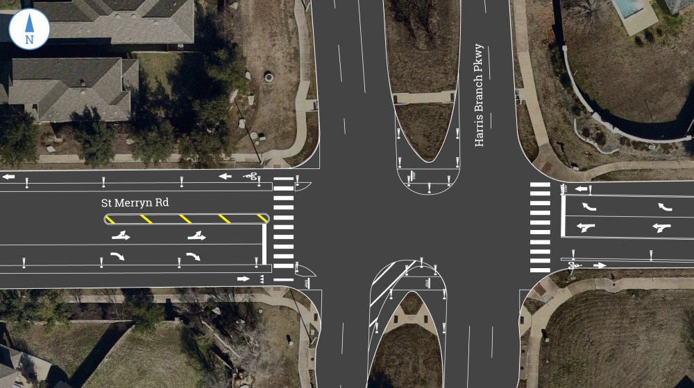
- At the intersection of Farmhaven Road and Harris Branch Parkway, a protected intersection would be installed with new street markings and physical protection. A mid-intersection stop and a refuge median would be added to break up the crossing into two stages, helping drivers, pedestrians and cyclists focus on one direction of cross traffic at a time. The refuge median shortens the distance across the general travel lane for more vulnerable street users and improves visibility and predictability for everyone. In order to make space for these changes, the lanes would be modified into a right-turn-only lane and a left and through lane on both sides of Farmhaven Road.
- Please review the animated video below for a demonstration of the proposed changes.
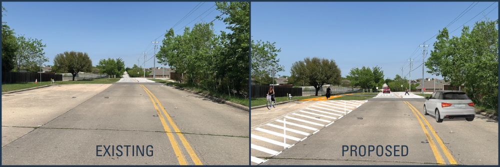
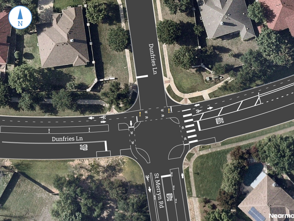
- At the intersection of Farmhaven Road and St. Merryn Road/Dunfries Lane, a new all-way stop and crosswalk was recently installed. Additional markings would be installed as shown in the drawing below.
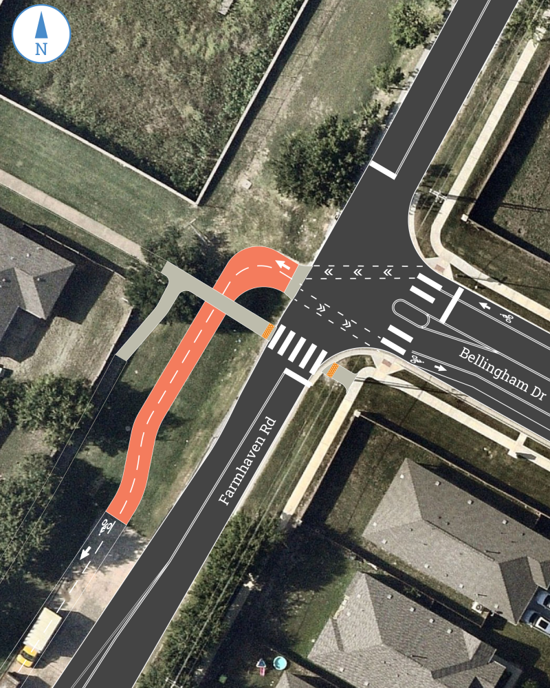
- At the intersection of Farmhaven Road and Bellingham Drive, a new all-way stop and crosswalk were recently installed. The two-way bikeway would continue off the street on a new section of concrete as shown in the drawing below.
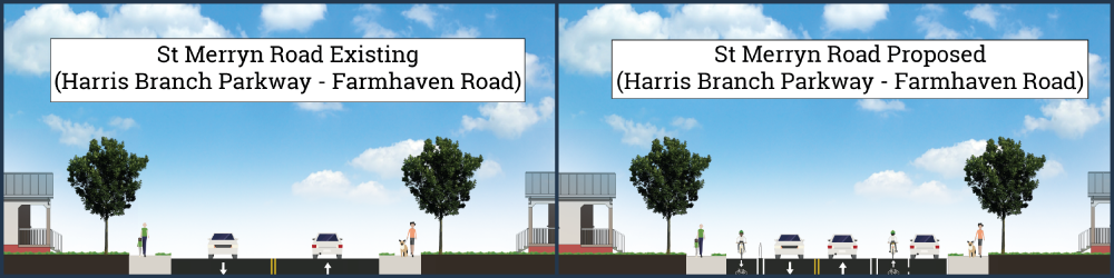
- New bike lanes with flex post protection would be installed from Farmhaven Road to Boyce Lane. Parking would be consolidated to the south side of the street.
- Six new pedestrian crossing islands are proposed along St. Merryn Road. Two new pedestrian crossings were recently constructed at Barns Trail.
- Proposed pedestrian crossing locations:
- Amaranth Lane (2 crossings)
- St. Merryn Greenbelt Trailhead
- Thistle Hill Way
- Kilbarchan Drive
- Carisbrooke Lane
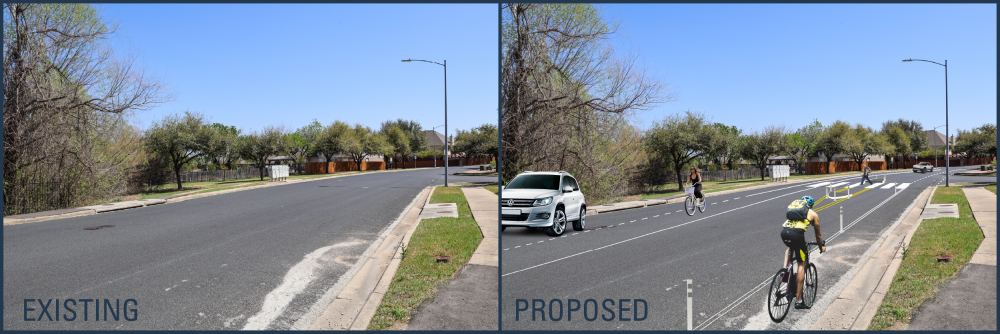
- New bike lanes with flex post protection would be installed from Kirkland Hill Path to Farmhaven Road.
- From Kirkland Hill Path to Harris Branch Parkway, parking would remain on the north side of the street to preserve access to the community mailboxes.
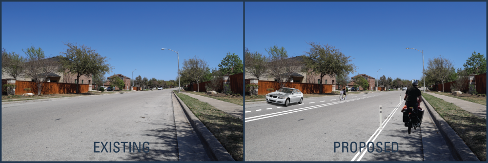
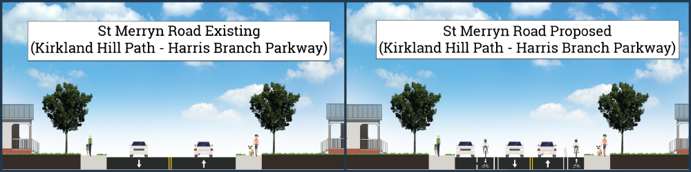
- From Harris Branch Parkway to Farmhaven Road, parking would be removed except along the community mailboxes on the south side of the street.
At the intersection of St. Merryn Road and Harris Branch Parkway, a right-turn-only lane and a shared left-turn/through lane would be added on both sides of St. Merryn Road. This lane configuration is intended to better organize turning movements and reduce potential conflict points between drivers and people walking or biking across Harris Branch Parkway. Median refuge spaces are also proposed as an extension of the existing medians. This space would provide a protected area for people biking to pause while waiting to cross Harris Branch Parkway, improving safety and comfort.
```
For questions, email MobilityBonds@austintexas.gov or call (512) 974-2300.